


HAVANA (AP) — Hurricane Ian was growing stronger as it barreled toward Cuba on a track to hit Florida’s west coast as a major hurricane as early as Wednesday.
Ian was forecast to hit the western tip of Cuba as a major hurricane and then become an even stronger Category 4 with top winds of 140 mph (225 km/h) over warm Gulf of Mexico waters before striking Florida.
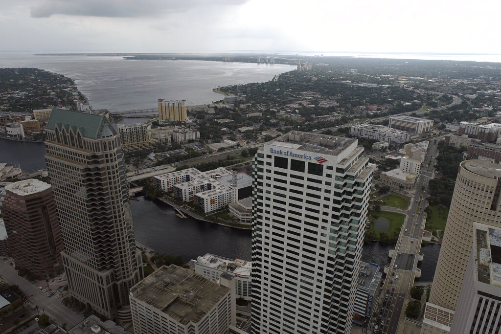
As of Monday, Tampa and St. Petersburg appeared to be the among the most likely targets for their first direct hit by a major hurricane since 1921.
“Please treat this storm seriously. It’s the real deal. This is not a drill,” Hillsborough County Emergency Management Director Timothy Dudley said at a news conference on storm preparations in Tampa.
Authorities in Cuba were evacuating 50,000 people in Pinar del Rio province, sent in medical and emergency personnel, and took steps to protect food and other crops in warehouses, according to state media.
“Cuba is expecting extreme hurricane-force winds, also life-threatening storm surge and heavy rainfall,” U.S. National Hurricane Center senior specialist Daniel Brown told The Associated Press.
The hurricane center predicted areas of Cuba’s western coast could see as much as 14 feet (4.3 meters) of storm surge Monday night or early Tuesday.
In Havana, fishermen were taking their boats out of the water along the famous Malecon, the seaside boardwalk, and city workers were unclogging storm drains ahead of the expected rain.
Havana resident Adyz Ladron, 35, said the potential for rising water from the storm worries him.
“I am very scared because my house gets completely flooded, with water up to here,” he said, pointing to his chest.
In Havana’s El Fanguito, a poor neighborhood near the Almendares River, residents were packing up what they could to leave their homes, many of which show damage from previous storms.
“I hope we escape this one because it would be the end of us. We already have so little,” health worker Abel Rodrigues, 54, said.
On Monday night, Ian was moving northwest at 13 mph (20 km/h), about 130 miles (209 kilometers) southeast of the western tip of Cuba, with top sustained winds increasing to 100 mph (155 km/h).
The center of the hurricane passed to the west of the Cayman Islands, but no major damage was reported there Monday, and residents were going back into the streets as the winds died down.
“We seem to have dodged the bullet” Grand Cayman resident Gary Hollins said. “I am a happy camper.”
Ian won’t linger over Cuba but will slow down over the Gulf of Mexico, growing wider and stronger, “which will have the potential to produce significant wind and storm surge impacts along the west coast of Florida,” the hurricane center said.
A surge of up to 10 feet (3 meters) of ocean water and 10 inches (25 centimeters) of rain was predicted across the Tampa Bay area, with as much as 15 inches (38 centimeters) inches in isolated areas. That’s enough water to inundate coastal communities.
As many as 300,000 people may be evacuated from low-lying areas in Hillsborough County alone, county administrator Bonnie Wise said. Some of those evacuations were beginning Monday afternoon in the most vulnerable areas, with schools and other locations opening as shelters.
“We must do everything we can to protect our residents. Time is of the essence,” Wise said.
Floridians lined up for hours in Tampa to collect bags of sand and cleared store shelves of bottled water. Gov. Ron DeSantis declared a statewide emergency and warned that Ian could lash large areas of the state, knocking out power and interrupting fuel supplies as it swirls northward off the state’s Gulf Coast.
“You have a significant storm that may end up being a Category 4 hurricane,” DeSantis said at a news conference. “That’s going to cause a huge amount of storm surge. You’re going to have flood events. You’re going to have a lot of different impacts.”
DeSantis said the state has suspended tolls around the Tampa Bay area and mobilized 5,000 Florida state national guard troops, with another 2,000 on standby in neighboring states.
President Joe Biden also declared an emergency, authorizing the Department of Homeland Security and the Federal Emergency Management Agency to coordinate disaster relief and provide assistance to protect lives and property. The president postponed a scheduled Tuesday trip to Florida because of the storm.
Playing it safe, NASA planned to slowly roll its moon rocket from the launch pad to its Kennedy Space Center hangar, adding weeks of delay to the test flight.
The Tampa Bay Buccaneers announced Monday night that the football team was relocating football operations to the Miami area in preparation for next weekend’s game against the Kansas City Chiefs. The Buccaneers said the team will leave Tampa on Tuesday and relocate in Miami-Dade County. The Buccaneers are expected to practice at the Miami Dolphins’ training complex in Miami Gardens, Florida, starting on Wednesday and continue through this week’s preparations, if necessary.
Flash flooding was predicted for much of the Florida peninsula, and heavy rainfall was possible for the southeast United States later this week. With tropical storm force winds extending 115 miles (185 kilometers) from Ian’s center, watches covered the Florida Keys to Lake Okeechobee.
Bob Gualtieri, sheriff of Pinellas County, Florida, which includes St. Petersburg, said in a briefing that although no one will be forced to leave, mandatory evacuation orders are expected to begin Tuesday.
“What it means is, we’re not going to come help you. If you don’t do it, you’re on your own,” Gualtieri said.
Zones to be evacuated include all along Tampa Bay and the rivers that feed it. St. Petersburg Mayor Ken Welch urged residents not to ignore any evacuation orders.
“This is a very real threat that this storm poses to our community,” Welch said.
The hurricane center has advised Floridians to have survival plans in place and monitor updates of the storm’s evolving path.
___
Associated Press contributors include Curt Anderson in St. Petersburg, Florida; Anthony Izaguirre in Tallahassee, Florida; and Julie Walker in New York.
Vulnerable Tampa Bay braces for storm not seen in a century
ST. PETERSBURG, Fla. (AP) — It’s been more than a century since a major storm like Hurricane Ian has struck the Tampa Bay area, which blossomed from a few hundred thousand people in 1921 to more than 3 million today.
Many of these people live in low-lying neighborhoods that are highly susceptible to storm surge and flooding they have rarely before experienced, which some experts say could be worsened by the effects of climate change.
The problem confronting the region is that storms approaching from the south, as Hurricane Ian is on track to do, bulldoze huge volumes of water up into shallow Tampa Bay and are likely to inundate homes and businesses. The adjacent Gulf of Mexico is also shallow.
“Strong persistent winds will push a lot of water into the bay and there’s nowhere for it to go, so it just builds up,” said Brian McNoldy, a senior research associate at the University of Miami’s Rosenstiel School of Marine, Atmospheric and Earth Science. “Tampa Bay is very surge-prone because of its orientation.”
The National Hurricane Center is predicting storm surge in Tampa Bay and surrounding waters of between 5 and 10 feet (1.5 and 3 meters) above normal tide conditions and rainfall of between 10 and 15 inches (12 and 25 centimeters) because of Hurricane Ian.
“That’s a lot of rain. That’s not going to drain out quickly,” said Cathie Perkins, emergency management director in Pinellas County, where St. Petersburg and Clearwater are located. “This is no joke. This is life-threatening storm surge.”
Officials in the area began issuing evacuation orders Monday for a wide swath of Tampa, with the St. Petersburg area soon to follow. The evacuations could affect 300,000 people or more in Hillsborough County alone.
Gov. Ron DeSantis took note of the region’s vulnerability in a Monday afternoon news conference in Largo, Florida.
“Clearly, when you look at the Tampa Bay area, one of the reasons why we fear storms is because of the sensitivity of this area and the fragility of this area,” DeSantis said.
The last time Tampa Bay was hit by a major storm was Oct. 25, 1921. The hurricane had no official name but is known locally as the Tarpon Springs storm, for the seaside town famed for its sponge-diving docks and Greek heritage where it came ashore.
The storm surge from that hurricane, estimated at Category 3 with winds of up to 129 mph ( 207 km/h) was pegged at 11 feet (3.3 meters). At least eight people died and damage was estimated at $5 million at the time.
Now, the tourist-friendly region known for its sugar-sand beaches has grown by leaps and bounds, with homes and businesses along the water the ideal locations — most of the time. Hurricane Ian could threaten all of that development.
Just as an example, the city of Tampa had about 51,000 residents in 1920. Today, that number is almost 395,000. Many of the other cities in the region have experienced similar explosive growth.
A report from the Boston-based catastrophe modeling firm Karen Clark and Co. concluded in 2015 that Tampa Bay is the most vulnerable place in the U.S. to storm surge flooding from a hurricane and stands to lose $175 billion in damage. A World Bank study a few years before that placed Tampa as the seventh-most vulnerable city to major storms on the entire globe.
Yet for years storms seemed to bypass the region somewhat inexplicably. Phil Klotzbach, research scientist in the Department of Atmospheric Science at Colorado State University, noted that only one of five hurricanes at Category 3 strength or higher has struck Tampa Bay since 1851.
“In general, cyclones moving over the Gulf of Mexico had a tendency of passing well north of Tampa,” the National Oceanographic and Atmospheric Administration said in report on the 1921 storm.
Also lurking in the waves and wind are the impacts of climate change and the higher sea levels scientists say it is causing.
“Due to global warming, global climate models predict hurricanes will likely cause more intense rainfall and have an increased coastal flood risk due to higher storm surge caused by rising seas,” Angela Colbert, a scientist at NASA’s Jet Propulsion Laboratory, wrote in a June report.
McNoldy, the University of Miami researcher, noted that Hurricane Andrew’s storm surge today would be 7 inches (17 centimeters) higher than it was when that storm pounded South Florida 30 years ago.
“As sea level rises, the same storm surge will be able to flood more areas because the baseline upon which it’s happening is higher,” McNoldy said.
Amid all the science, a local legend has it that blessings from Native Americans who once called the region home have largely protected it from major storms for centuries. Part of that legend is the many mounds built by the Tocobagan tribe in what is now Pinellas County that some believe are meant as guardians against invaders, including hurricanes.
Rui Farias, executive director of the St. Petersburg Museum of History, told the Tampa Bay Times after Hurricane Irma’s near miss in 2017 that many people still believe it.
“It’s almost like when a myth becomes history,” Farias said. “As time goes on, it comes true.”
It appears Hurricane Ian will give that legend a test in the coming days.
___
Associated Press writer Anthony Izaguirre in Tallahassee contributed to this story.